
Contents
- 🛰️ Introduction to Remote Sensing
- 🌎 Applications of Remote Sensing
- 📸 Types of Remote Sensing
- 🛰️ Satellite Remote Sensing
- 🛸 Airborne Remote Sensing
- 🚁 Ground-Based Remote Sensing
- 📊 Data Analysis and Interpretation
- 🌐 Remote Sensing and GIS
- 💡 Future of Remote Sensing
- 🚨 Challenges and Limitations
- 👥 Remote Sensing Community
- 📚 Conclusion
- Frequently Asked Questions
- Related Topics
Overview
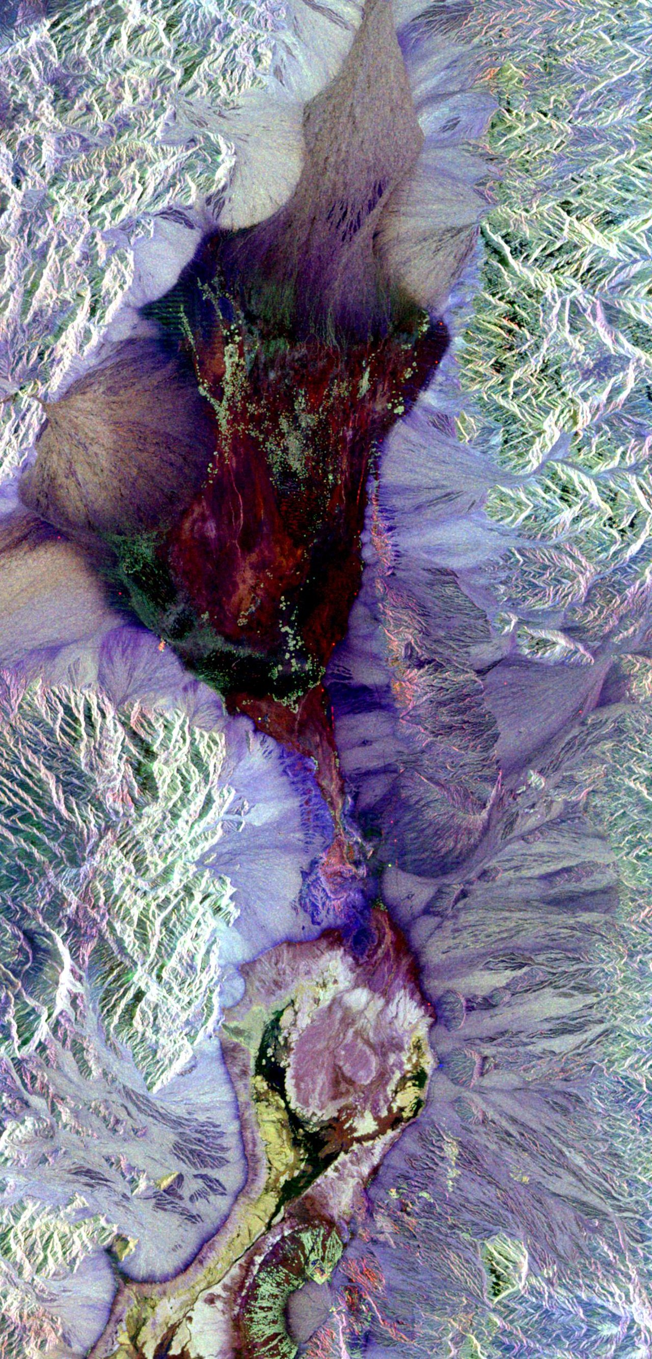
Remote sensing has revolutionized our understanding of the Earth, enabling us to monitor climate change, track natural disasters, and manage natural resources. With a history dating back to the 1960s, remote sensing has evolved significantly, from the launch of the first Earth Resource Technology Satellite (ERTS-1) in 1972 to the current era of high-resolution satellite imagery and drone-based sensing. The technology has a wide range of applications, including land use mapping, crop yield prediction, and disaster response, with key players such as NASA, the European Space Agency (ESA), and private companies like Planet Labs and DigitalGlobe. However, remote sensing also raises concerns about data privacy, security, and the digital divide, highlighting the need for responsible innovation and regulation. As the field continues to advance, we can expect to see new breakthroughs in areas like artificial intelligence, machine learning, and the Internet of Things (IoT), further transforming the way we interact with and understand our planet. With a vibe score of 8, remote sensing is an exciting and rapidly evolving field that is poised to shape the future of Earth observation and beyond.
🛰️ Introduction to Remote Sensing
Remote sensing is a crucial technology in the field of Geospatial Technology, allowing us to acquire information about an object or phenomenon without making physical contact with the object. This technique has numerous applications in various fields, including Geophysics, Geography, and Land Surveying. Remote sensing is used to study the Earth and other planets, and its applications range from Military Applications to Humanitarian Applications. The use of remote sensing has become increasingly important in recent years, with the development of new technologies and sensors. For example, Hyperspectral Remote Sensing has enabled the collection of detailed information about the Earth's surface. Additionally, Lidar Technology has improved the accuracy of remote sensing data.
🌎 Applications of Remote Sensing
The applications of remote sensing are diverse and widespread. In the field of Agriculture, remote sensing is used to monitor crop health and yield. In Urban Planning, remote sensing is used to study urban growth and development. Remote sensing is also used in Disaster Response to assess damage and provide critical information for relief efforts. Furthermore, remote sensing has applications in Climate Change research, where it is used to study the effects of climate change on the environment. For instance, Sea Level Rise can be monitored using remote sensing techniques. Moreover, remote sensing is used in Wildlife Conservation to track and monitor animal populations.
📸 Types of Remote Sensing
There are several types of remote sensing, including Passive Remote Sensing and Active Remote Sensing. Passive remote sensing involves the detection of natural radiation emitted or reflected by objects, while active remote sensing involves the emission of radiation by the sensor itself. Other types of remote sensing include Optical Remote Sensing and Radar Remote Sensing. Each type of remote sensing has its own advantages and disadvantages, and the choice of technique depends on the specific application and requirements. For example, Multispectral Remote Sensing is used to collect data on the reflectance properties of objects, while Thermal Remote Sensing is used to collect data on the temperature of objects.
🛰️ Satellite Remote Sensing
Satellite remote sensing is a widely used technique that involves the use of satellites in orbit around the Earth to collect data. Satellites such as Landsat and MODIS have been used for decades to collect data on the Earth's surface. Satellite remote sensing has numerous applications, including Land Cover Mapping and Crop Yield Prediction. The use of satellite remote sensing has improved significantly in recent years, with the development of new sensors and technologies. For example, Sentinel-2 has provided high-resolution data on the Earth's surface, while Gaofen has provided data on the Earth's surface with high spatial and temporal resolution.
🛸 Airborne Remote Sensing
Airborne remote sensing involves the use of aircraft to collect data on the Earth's surface. This technique is often used for Aerial Photography and Aerial Mapping. Airborne remote sensing has numerous applications, including Topographic Mapping and Environmental Monitoring. The use of airborne remote sensing has improved significantly in recent years, with the development of new sensors and technologies. For example, Hyperspectral Imaging has enabled the collection of detailed information about the Earth's surface, while Lidar Mapping has improved the accuracy of airborne remote sensing data.
🚁 Ground-Based Remote Sensing
Ground-based remote sensing involves the use of sensors on the ground to collect data on the Earth's surface. This technique is often used for Soil Moisture Monitoring and Water Quality Monitoring. Ground-based remote sensing has numerous applications, including Agricultural Monitoring and Ecosystem Monitoring. The use of ground-based remote sensing has improved significantly in recent years, with the development of new sensors and technologies. For example, Wireless Sensor Networks have enabled the collection of data on the Earth's surface with high spatial and temporal resolution.
📊 Data Analysis and Interpretation
Data analysis and interpretation are critical components of remote sensing. The data collected through remote sensing must be analyzed and interpreted to extract meaningful information. This involves the use of various techniques, including Image Processing and Data Mining. The use of Machine Learning and Deep Learning has improved significantly in recent years, enabling the extraction of complex patterns and relationships from remote sensing data. For example, Object-Based Image Analysis has enabled the extraction of detailed information about objects on the Earth's surface.
🌐 Remote Sensing and GIS
Remote sensing is closely related to GIS, which involves the use of geographic information systems to analyze and interpret spatial data. The integration of remote sensing and GIS has enabled the creation of detailed maps and models of the Earth's surface. This has numerous applications, including Urban Planning and Natural Resource Management. The use of remote sensing and GIS has improved significantly in recent years, with the development of new technologies and sensors. For example, Web GIS has enabled the sharing and dissemination of remote sensing data and GIS maps.
💡 Future of Remote Sensing
The future of remote sensing is exciting and rapidly evolving. New technologies and sensors are being developed, enabling the collection of data with higher spatial and temporal resolution. The use of UAV Remote Sensing and Satellite Constellations is becoming increasingly popular, enabling the collection of data on the Earth's surface with high frequency and accuracy. Additionally, the use of Artificial Intelligence and Machine Learning is improving the analysis and interpretation of remote sensing data.
🚨 Challenges and Limitations
Despite the numerous applications and benefits of remote sensing, there are also challenges and limitations. One of the major challenges is the Data Quality, which can be affected by various factors such as atmospheric conditions and sensor errors. Another challenge is the Data Availability, which can be limited by factors such as cloud cover and satellite orbits. The use of remote sensing also raises concerns about Privacy and Security, particularly in the context of Military Applications.
👥 Remote Sensing Community
The remote sensing community is a diverse and vibrant community, comprising researchers, practitioners, and users from various fields and disciplines. The community is supported by various organizations and institutions, including IEEE and ISPRS. The community also organizes various conferences and workshops, including IGARSS and SilviLaser. These events provide a platform for the exchange of ideas and knowledge, and for the discussion of the latest developments and advancements in remote sensing.
📚 Conclusion
In conclusion, remote sensing is a powerful technology that has numerous applications and benefits. The use of remote sensing has improved significantly in recent years, with the development of new technologies and sensors. However, there are also challenges and limitations that need to be addressed. The remote sensing community is a diverse and vibrant community, and it is expected to continue to grow and evolve in the coming years. As the technology continues to advance, we can expect to see new and innovative applications of remote sensing, including Precision Agriculture and Smart Cities.
Key Facts
- Year
- 1972
- Origin
- NASA's ERTS-1 Satellite Launch
- Category
- Geospatial Technology
- Type
- Technology
Frequently Asked Questions
What is remote sensing?
Remote sensing is the acquisition of information about an object or phenomenon without making physical contact with the object. It involves the use of various technologies, including satellites, aircraft, and sensors, to collect data on the Earth's surface. Remote sensing has numerous applications, including Land Cover Mapping, Crop Yield Prediction, and Disaster Response.
What are the types of remote sensing?
There are several types of remote sensing, including Passive Remote Sensing and Active Remote Sensing. Passive remote sensing involves the detection of natural radiation emitted or reflected by objects, while active remote sensing involves the emission of radiation by the sensor itself. Other types of remote sensing include Optical Remote Sensing and Radar Remote Sensing.
What are the applications of remote sensing?
The applications of remote sensing are diverse and widespread. Remote sensing is used in Agriculture to monitor crop health and yield, in Urban Planning to study urban growth and development, and in Disaster Response to assess damage and provide critical information for relief efforts. Remote sensing is also used in Climate Change research, where it is used to study the effects of climate change on the environment.
What is the difference between remote sensing and GIS?
Remote sensing and GIS are closely related, but they are not the same thing. Remote sensing involves the collection of data on the Earth's surface using various technologies, including satellites and sensors. GIS, on the other hand, involves the analysis and interpretation of spatial data using geographic information systems. The integration of remote sensing and GIS has enabled the creation of detailed maps and models of the Earth's surface.
What is the future of remote sensing?
The future of remote sensing is exciting and rapidly evolving. New technologies and sensors are being developed, enabling the collection of data with higher spatial and temporal resolution. The use of UAV Remote Sensing and Satellite Constellations is becoming increasingly popular, enabling the collection of data on the Earth's surface with high frequency and accuracy. Additionally, the use of Artificial Intelligence and Machine Learning is improving the analysis and interpretation of remote sensing data.
What are the challenges and limitations of remote sensing?
Despite the numerous applications and benefits of remote sensing, there are also challenges and limitations. One of the major challenges is the Data Quality, which can be affected by various factors such as atmospheric conditions and sensor errors. Another challenge is the Data Availability, which can be limited by factors such as cloud cover and satellite orbits. The use of remote sensing also raises concerns about Privacy and Security, particularly in the context of Military Applications.
What is the remote sensing community?
The remote sensing community is a diverse and vibrant community, comprising researchers, practitioners, and users from various fields and disciplines. The community is supported by various organizations and institutions, including IEEE and ISPRS. The community also organizes various conferences and workshops, including IGARSS and SilviLaser. These events provide a platform for the exchange of ideas and knowledge, and for the discussion of the latest developments and advancements in remote sensing.